

When we were there I didn’t know anything about them, but they were close to the road so I just had to climb up and have a look.
As I climbed the slope to the cave mouths I watched the ground closely. As I went I began to notice fragments of shell scattered through the grass.

Back in my university days I spent a few field seasons on some Archaeology digs and surveys. I have vivid memories of spending a full month helping a friend sort ancient fish bone and shells from a coastal Aboriginal midden (rubbish heap) as she gathered data for her thesis. It was simultaneously fascinating and ridiculously tedious, but I learnt a lot about coastal archaeology in the process.
The shell material I saw scattered down the slope was very reminiscent of that midden, and others I have seen. So as I climbed the slope to those caves I was fairly sure they had been used by Aboriginal people as rock shelters.
The largest cave
 had a sandy floor in one corner. This sand was also littered with tiny shell fragments.
 My impression of long term use was further concreted by what appears to be heavy smoke staining, possibly from hundreds of years of camp fires.
 One corner of the large cave held this large pillar formed when a stalactite and stalagmite joined.
 At the far end of the complex is a lower, but deeper cave.
 It also has a sandy floor this time with very recognisable shells and pieces of charcoal.
 This piccie is taken looking out of the smaller cave.
 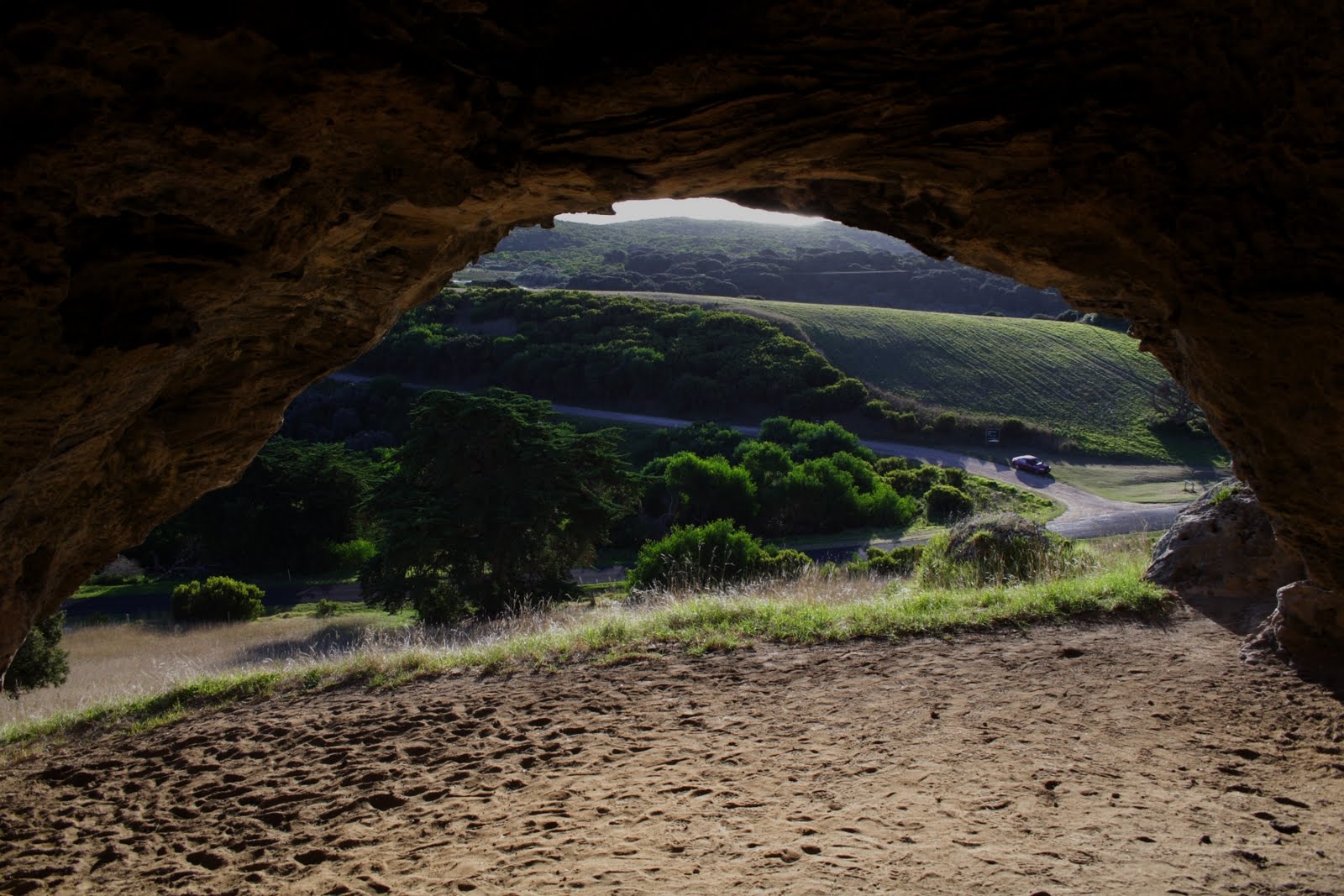 The car parked near the junction is ours, Deb was no doubt knitting as she waited for me.
The view from the cave mouth, it is easy to see why the local people chose to use this spot. Quite apart from the nearby marine resources and the shelter, it is simply beautiful.
 As we drove away I commented to Deb that I would have to find out if there was any information on prehistoric use of the caves.
Well I found a little, records I could access indicated that the caves were in use.
Also there was an Aboriginal myth associated with the cave. They apparently believed their creator spirit Bundjil sometimes lived in one of the caves and also descended from there to “walk the shore”.
Then I found this an engraving made by Thomas Ham, a surveyor in 1851
 Thomas took some licence with the background but the basic shape is right when looking out of the cave, in particular the pillar on the right is very recognisable. Also if you compare it with my piccie of the view the basic propertions of the cape in the distance are more or less right.
I wonder if there were Aboriginal people there when Thomas Ham visited? Or were they added to the sketch for “colour”?
The British visitors with their early Victorian period formal attire crack me up. How different was my attire, jeans and t-shirt!


